A blog of the bicycling adventures of Larry Plumlee. Mostly in Arkansas and Missouri, but a few out-of-state rides.
Wednesday, December 14, 2011
Ride Across Arkansas, Sept 24-29, 2011. Day 1 through day 4.
Note: Click on photos to enlarge them. To speed up loading of photos, days 5 through 7 are listed as separate stories. Just follow links at bottom of each page to follow.
Twice I've ridden across Iowa as part of their annual RAGBRAI. I decided it was time I needed to see my home state at 10mph. Told my wife, I wasn't going to do RAGBRAI again, until I rode across Arkansas. So on Saturday afternoon, September 24th, we started riding at the Arkansas/Missouri state line, at Blue Eye, MO. My riding partner for the ride is our family friend, Jerrie Joubert. My wife has always claimed Jerrie as her adopted sister. We've known Jerrie and her husband, Scot, for many years. Our kids were about the same age as there kids. My wife is not a cyclist, but a very willing SAG support person. "SAG" is short for "Support And Gear", in other words, the person who hauls our supplies. She'll be driving the car, meeting us for lunch, and at the end of the day meet us for our over-night lodging.
If you have any questions, corrections, or comments and would like to contact me, my email is: dad_5ks@yahoo.com
Day 1, Saturday, September 24: Blue Eye, MO to Batavia, AR Map of day 1: http://www.mapmyride.com/routes/view/54913756
Blue Eye, MO is just 5 miles from my home in Oak Grove, AR. My wife, Lajunta drove Jerrie and I to Blue Eye, where she did the ceremonial photos at the state line signs. Was a festive beginning, as it was the annual "Blue Eye Reunion". So the Blue Eye city park was full of vendors, musicians, and spectators. We didn't leave Blue Eye until about 3:30, as Saturday morning was the second annual St John's bicycle ride in Berryville, which I help organize.
From Blue Eye, we rode on hwy 21 to Oak Grove From there we took hwy 103 to Green Forest, where we turn onto hwy 62E to Alpena. A couple miles past Alpena, we turned right onto 392 to Batavia. We only did 30.47 miles. It's not a race for us (which is good, since I'm more of a "clydesdale" on a bike, not a "thoroughbred"). Was great riding weather. Lajunta picked us up at the convenience store in Batavia. It was nicely decorated for fall. We returned home for the night. Plans were to resume next morning, and head towards Jasper. Took some fun photos of the Batavia store.
Mileage today, approximately 30 miles.
Jerrie and I at the Arkansas/Missouri state line in Blue Eye. City park behind us was site of annual Blue Eye reunion.
One of several vendors at the Blue Eye reunion.
Jerrie leaving Blue Eye, first mile of trip.
First rest stop of the day....Green Forest square. Green Forest is the where the school is located that I spent years 4 thru 12...."Class of 1975".
Safe riding for a while outside of Green Forest on hwy 62. Riding on the "closed" section of the new road.
Road side vendor in Alpena.
Chainsaw art in Alpena. Woo Pig, Sooie!
The end of day one, the store in Batavia.
Day 2, Sunday September 25: Batavia to top of mountain just past Jasper Map of day 2: http://www.mapmyride.com/routes/view/54914036
We got a later start than planned today, as Lajunta and I had to pack. We've had a busy last few days in the studio, getting caught up so we can take off a few days. By the time we picked Jerrie up at her home, drove to Batavia, it was almost 10:30 before we were on the road. We ran into a gentleman at the store who was shopping there the night before. Then we ran into him again that day. More about that later.
At the town of Capps, we took Creel Road, which was a short cut around Harrison...or was supposed to be. However, we took a wrong turn (went left on 43, should have gone right), and ended up back in Harrison. We then hit infamous "scenic" highway 7 (scenic is a "code word" for "hilly and curvy). We'll be getting VERY acquainted with hwy 7 the next few days.
It's a beautiful ride down 7. Lots of curves to Jasper, and a hill out of Pruitt. We crossed the Buffalo River, had to stop and do some photos....beautiful! Just don't let the Park Ranger catch you walking on the bridge to do photos...ask Lajunta about that one....lol.
After climbing a mile-long hill past Pruitt, we met Lajunta in Jasper for lunch, at about 2:00. Found some nice picnic tables as we entered Jasper. Then it was on to the hill that I'd dreaded for the entire trip...the 3 1/2 mile, 7% climb south of Jasper (actually found out later, it's a 5 mile climb!). I checked my clock as we began the slow, steady climb. I think we stopped about 3 times up the hill, to get our breath. The closer and closer we got to the top, the foggier it got (or maybe we were just climbing into the clouds...lol). Anyway, it took exactly one hour to make it to the overlook tower, 3 1/2 miles up the mountain. Visibility was less than 100' when we reached to top at 3:45, so we decided to call it quits for the day. I get a little goofy on long rides, so as we approached the top, I knew my wife was waiting for us with the car. So when I began to make out the outline of the overlook tower, Jerrie and I started hollaring, "Lajunta? Lajunta?" Soon we seen her, parked beside the road. Indeed, she had heard us, before she could see us! After debating on what to do, we decided to return home (about a one hour drive) and return tomorrow to continue.
We decided it would be a good idea to pick up a couple of flashers to put on our bikes, so we stopped at the Walmart store in Harrison. Guess who Jerrie ran into? It was the man from the Batavia store, whom we'd seen the day before and that morning! Jerrie said, "Aren't you the guy from the Batavia store? It's us, the bicycle people!" He said, yes, he'd recognized us!
Today's mileages, approximately 31 miles.
Creel Road, south of Capps, headed towards hwy 43.
I always like to stop and look over the edge to see what's under bridges. Sometimes it amazes you, sometimes puzzles you.
Scenic Hwy 7, south of Harrison. Lots of hills and curves, but a nice shoulder to ride on. Felt safe.
The marker says, "This marker commemorates the Arkansas marble in Washington's Monument taken by Beller and Harp Bros. from this hill in 1836. This marker erected 1954 by Newton Co History Society....etc.
One of many lodging options for tourists.
The Buffalo River, taken from the bridge on hwy 7 between Harrison and Jasper.
Photo op.
Arriving in Jasper.
Lunch in Jasper.
Lajunta and Larry at the Jasper lunch stop.
Leaving Jasper, getting ready for the big climb!
Down town Jasper. Don't see many vegetarian options on this menu. Elk were stocked near Jasper a few years ago and I believe they have some sort of Elk Festival. You can see them, especially in the fall of the year, around the Buffalo River near Ponca.
Down Town Jasper, Arkansas.
Riding into the clouds.
Going up the mountain, starting to get foggy.
By the time we reached what we thought was the top of the hill south of Jasper, it was 3:45 and visibility was less than 100' due to fog. Decided it would be smart stop for the day.
Loading up the bikes, calling it quits for the day.
Day 3, Monday September 26: Top of mountain just past Jasper to Russellville. Map of day 3: http://www.mapmyride.com/routes/view/54914216
We got an earlier start today. We picked Jerrie up at her home a little past 6:30. After a stop in Harrison, we arrived where we'd stopped last night, on the mountain just south of Jasper. The fog was beautiful, covering the valleys (mountain top was clear!). By 8:30, we were on the road. We thought we were at the top of the mountain, but there was another 1 1/2 miles of gradual climbing before we peaked out on top. So the entire climb from Jasper is closer to 5 miles.
Hwy 7 is not a bad road to cycle, good shoulders most of the way with plenty of scenic stops, where we stopped to do photos. It was mostly rolling hills for about 40 miles or so, none as long as the hill out of Jasper, but some that were steep. Stopped several times before noon, to take photos. Lajunta waited for us at Pelsor, where we had lunch on a picnic table at an abandoned country store. It was a fun ride the last 20 miles or so, many nice downhills, before we finally hit the Arkansas River valley. It was smooth riding once we hit the flat lands. We met Jerrie's son, Guy, at his home. We've know Guy since he was 2 y/o. Tonight, we are staying with Guy's girl friend, Kelsey. We went out for dinner, had Mexican food at Guy's favorite Mexican restaurant, La Huerta. Good food at a VERY affordable price. After dinner, Kelsey gave us a tour of campus, and we stopped by to see where Guy works, at a screen printing shop. One funny thing that happened today, I was riding off a long hill, probably around 32-34 mph, hanging on for dear life, when a huge shadow passed over me. Sort of startled me at first, wasn't sure what was going on. I looked up to see a huge military airplane, followed by a second one, flying very low.
Today's mileage, a about 65 miles.
Our morning began where we'd left off the previous afternoon. This was taken by the tower and gift shop, 3 1/2 miles up the mountain south of Jasper on hwy 7.
Hey, I remember that stuff!
Yes, it was cool that morning. Was about 40 degrees when we left home. Last day of ride, it got to 99 degrees.
Beautiful day for a bike ride!
This guy followed me most of the time.
Services! Restrooms and snacks. Also a large selection of.....hmm.....stuff. Sort of Flea Market type merchandise.
I suspect the hwy department must have planted these yellow wild flowers, as we seen them most of the day.
Thought we'd see more wild life, but this coyote was all I seen while on the bike. Jerrie seen a deer or two.
Several lumber trucks passed us. They were usually kind to give us plenty of room.
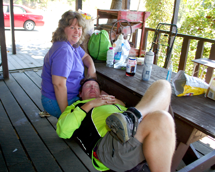
A little post-lunch nap. A Plumlee tradition.
One of several scenic overlooks along hwy 7. This particular one was the "Rotary Ann Reststop and Overlook" in the Ozark National Forest. Nice clean restrooms too!
Looking back, where we'd been all day.
After lunch, most of the long hills were down hill, not up.
One of the most beautiful signs you'll see on a long day of cycling.
Finally, the river valley! Good bye hills....for now.
Entering the town of Dover. Has a nice convenience store.
Lajunta was waiting for us at a convenience store in Dover. Time to kick off the shoes for awhile and snack on my home-made trail mix. Amazing how nice cold concrete can feel!
The campus of Arkansas Tech in Russellville. We were greeted by the band!
Left to right: Larry, Lajunta, Jerrie, Guy, and Kelsey after our evening meal at La Huerta Mexican restaurant in Russellville.
Day 4, Tuesday September 27: Russellville to Mt Ida. Map of day 4: http://www.mapmyride.com/routes/view/54914288
Today was a day of extremes. The morning ride could not have been much easier, mostly flat land across the Arkansas River Valley. Went through some nice little towns, stopped and visited with several people. Leaving Russellville on hwy 7, we crossed the Arkansas River to the town of Dardanelle. Stopped at a convenience store in Centerville where we had a nice visit with a couple of local people. Fellow told us about a relative who was an undercover drug agent and a few of his drug busts. Also talked about how the dry weather was hurting the farmers. Then we continued on hwy 7. In Ola, we left hwy 7 and turned onto hwy 28 to Plainview. What a delightful time we had in Plainview. We stopped at a little convenience store, which had a deli and lots other items. We started on down the road and discovered the town had a beautification committee that had done wonders to the town. Old, abandon buildings had been torn down, and facades had been built of various old-time buildings. There was also a small school building and small church. It was all decorated for fall. Found out last Saturday was their annual "Frontier Day". We visited with Kim at the city hall, a very friendly lady who told us all about the town. Several murals decorate buildings, all painted by local artists. We did lots of photos, will have those posted soon.
Jerrie and I took a break in Plainview, and waited for Lajunta to bring us lunch. We found a wrought iron table and chair set, that we used for lunch. After lunch, we headed to the next town, Rover, where we turned onto hwy 27. The easy riding for the day was over. It was the most difficult terrain of the whole trip. The hills were long and at times steep (not as long as coming out of Jasper on hwy 7, but many were probably a mile or more in length). There were few homes, as we mostly rode through forest land. We seen the town of Onyx on our map, and planned to stop there to refill our water bottles. However when we arrive at Onyx, we found it consisted of only one house. That's one thing about biking in unfamiliar territory, you never know when to expect to be able to fill your water bottles. Our water was getting very low, so I told Jerrie to start looking for someone in their yard. I'm not too proud to stop and ask for water. We passed through the community of Aly, which was about a half dozen houses. We seen two gentlemen sitting in their yard, enjoying life. I pulled into their yard and asked, "Mind if we use your outside hydrant to get some water?" No problem, sure we could. We enjoyed a brief visit with the two fellows, as they told us about the bears they had killed in the area (and how good bear meat was to eat). Also told us they'd seen mountain lions, panthers, and a big black cat with a long tail and white spots! Luckily, the most scary thing we seen that day was a couple of large tarantula spiders crossing the road. Wish we could have visited longer, I bet they could have told use some interesting tales.
We continued and finally found a convenience store at the town of Story. This was about 23 miles since we'd seen the last store. Once again we met some delightful people. Sometimes I wish I'd carried a tape recorder and recorded the conversations with the people. Seems everyone has a story to tell. An elderly gentleman named Jerry was having a bite to eat (the store also had a rather extensive food menu). He couldn't believe we were riding bicycles, said they get lots of motorcyclist who stop in. I think we could have visited with him for a long time.
It was time to hit the road, as we needed to get to Mt Ida before it got too late. The rest of the route to Mt Ida was much easier riding, and we arrived there in plenty of time before dusk. Lajunta was waiting for us, and we loaded our bikes for a short trip to our motel. I seen a Subway, and suddenly craved a veggie sandwich. I went in and ordered one, and met a delightful young lady named Shila who worked there. She was very interested in our ride, so I gave her a card with a link to this site. Found out she'd moved there from California. That must have been a major culture shock! Lajunta had got us a room at the Royal Oak Motel. Nothing fancy, but a good room for $49.
Mileage for the day was about 68 miles.
Crossing the Arkansas River on hwy 7, just south of Dardanelle. I believe that's the Arkansas Nuclear One power plant in the distance.
We had several miles of riding nice, easy terrain for about the first 30 miles today. We weren't headed towards those mountains. One or both of those might be Mt Mazazine and/or Mt Nebo. If you know, email me: dad_5ks@yahoo.com
Enjoyed a nice visit with this couple at the store in Centerville.
Hitching our "steads" at the hitching post for lunch.
We pulled wrought iron furniture to the shade side of the building and had lunch on the side walk in Plainview.
Had a nice visit with Kim at the Plainview city hall. Told us all about the town and their recent "Frontier Day". Told us local artists had painted the various murals we seen on buildings.
What a delight we discovered in Plainview! One of the painted murals and facades.
Hope this is not where they pull over the suspected DWI drivers and ask them to walk a straight line!
Onyx...sounds like a good place to stop and refill our water bottles, since Mt Ida is 38 miles away. Only problem, Onyx consisted of just one building...a home.
Rover to Story was mostly climbing steep hills, and then coasting down the other side.
I felt like we were on a roller coasters most of the afternoon. See why?
We were sure happy to see these gentlemen. We were getting low on water, and they let us use their outdoor faucet to fill our water bottles. They told us some interesting tales about the wildlife in the area. Lions and tigers and bears, oh my!
Visited briefly with "Jerry" at the "Story Junction Grocery & Deli".
Crossing the Ouachita River (for those of you not from Arkansas, that's pronounced "Wash-A- Taw".)
"Shila" made me a sandwich at the Subway in Mt Ida. She was a very friendly young lady, who seemed interested in our trip. I gave her one of my business cards with a link to this site.


Very scenic Larry! I floated on that section of the Buffalo River.
ReplyDeleteSo many interesting places and people!
Can't wait to see more.
Great story! Great pics!
ReplyDeleteLove the Louisiana border pic of you two!
My theory on the possum. He was busy eating and not watching traffic. And then BAM! lol
Wouldn't you love to have shoulders like the final stretch everywhere you rode!
Hey I love the descriptions.
ReplyDeleteDriven many of these roads. Steep!
I'm impressed!